Why Construction Engineer Matters in Water Projects
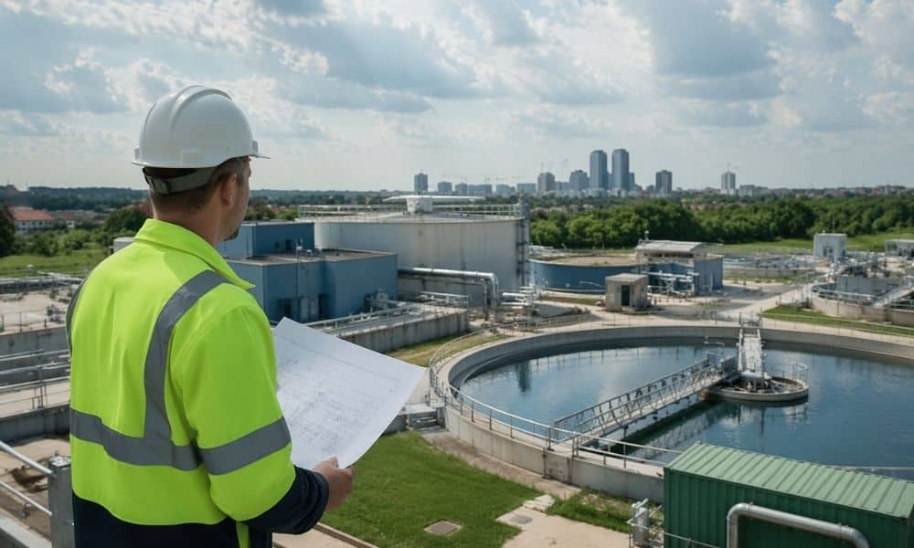
Fort Worth keeps growing. New homes go up fast, and new commercial spaces follow. At first, it feels like there’s plenty of land and plenty of opportunity. But growth like this always runs into a limit. That limit is infrastructure. The Mary’s Creek Water Project shows where Fort Worth is heading next. It’s not just […]
What a Viral Listing Reveals About an ALTA Title Survey
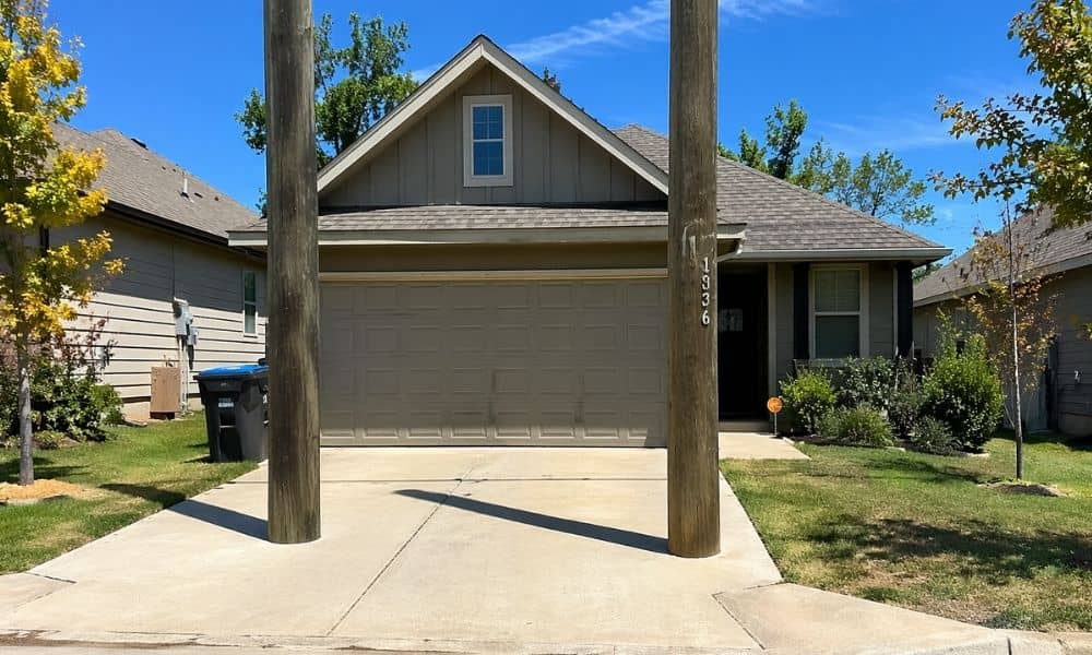
A home in Texas went viral for the wrong reason. At first glance, the listing looked normal. Nice photos. Clean layout. Good price. But then people noticed something odd. Two large utility poles sat right in the driveway. Not near it. Not beside it. Right in the middle. The internet had a field day. Some […]
Why a Traffic Engineer Checks Drive-Thru Queue Length

A drive-thru sounds simple. Cars pull in, place an order, and move forward. On a plan, it looks clean and easy to manage. But once the doors open, things change fast. A coffee shop gets busy at 7 a.m. A fast-food spot fills up at lunch. Cars stack up, then keep coming. Soon, the line […]